
In an unprecedented technological defense against accelerating environmental volatility, the National Disaster Management Authority (NDMA) and the Pakistan Meteorological Department (PMD), in strategic coordination with the Ministry of Climate Change, have officially operationalized the National AI Climate & Multi-Hazard Early Warning System (MEWS) 2026.
The sovereign supercomputing network bridges real-time meteorological observations with deep physics-informed neural networks (PINNs), shifting Pakistan’s disaster response from reactive mitigation to proactive, automated 72-hour advance prediction. Powered by high-performance domestic compute clusters, the system autonomously analyzes atmospheric turbulence, river catchment basins, high-altitude glacial lakes, and dense urban hydrology to forecast Glacial Lake Outburst Floods (GLOFs), monsoon cloudbursts, and heatwaves with sub-kilometer pinpoint precision.
To guarantee fault-tolerant telemetry processing, mission-critical meteorological workloads require zero-latency domestic computing fabrics deployed on enterprise Dedicated Servers and sovereign Dedicated Servers in Pakistan.
1. Climate Vulnerability and Legacy Forecasting Constraints
Pakistan consistently ranks among the world’s top ten most vulnerable nations to climate catastrophe. Across the northern mountain ranges of Gilgit-Baltistan and Khyber Pakhtunkhwa, more than 3,000 glacial lakes formed by retreating Himalayan, Karakoram, and Hindu Kush ice packs present continuous risks of catastrophic GLOF events. Simultaneously, southern and central economic corridors regularly battle catastrophic monsoon deluges and urban flooding across Karachi, Lahore, and Rawalpindi, alongside scorching spring heatwaves exceeding 50 degrees Celsius across Sindh and Balochistan.
Historically, disaster mitigation teams were constrained by legacy numerical weather prediction (NWP) infrastructure and manual radar observations:
- Narrow Prediction Windows: Traditional atmospheric models required 6 to 12 hours of compute batch processing to complete single-run projections, delivering actionable alerts only hours before river cresting or flash-flood surges occurred.
- Coarse Spatial Resolution: Legacy forecasts operated on 9km to 25km geographic grids, failing to isolate localized cloudburst events where massive precipitation dumps across a single valley or urban municipal sector while neighboring sectors remain dry.
- Siloed Sensory Data: Telemetry from Doppler weather radars, water flow gauges, and satellite streams resided in disparate, non-interoperable ministerial databases, inhibiting synchronized real-time threat intelligence.
The operationalization of MEWS 2026 directly eliminates these systemic bottlenecks.
2. Supercomputing Architecture: Neural Operators & Physical Modeling
The technological core of MEWS 2026 integrates advanced numerical weather simulations with deep learning operators, achieving compute execution speeds orders of magnitude faster than conventional supercomputer iterations.
High-Resolution WRF Assimilation
The computational grid runs high-resolution Weather Research and Forecasting (WRF) models downscaled to a 1-kilometer grid over high-risk ecological basins. Rather than calculating raw fluid dynamic Navier-Stokes partial differential equations across billions of grid cells via pure brute force, the architecture incorporates Fourier Neural Operators (FNOs) and Physics-Informed Neural Networks (PINNs). These neural surrogate models emulate atmospheric state transitions in fractional seconds while preserving thermodynamic and mass conservation laws.
Continuous Multi-Source Ingestion Grid
The ingestion pipeline continuously aggregates heterogeneous sensory streams:
- Dual-Polarization Radars: High-frequency digital feeds from PMD’s C-band and S-band Doppler radar installations in Islamabad, Karachi, Lahore, Multan, Gwadar, and Sukkur, providing real-time hydrometeor classification and rain-rate estimation.
- Automated Weather Stations (AWS): Hundreds of solar-powered IoT telemetry units situated across northern watersheds and southern plains, measuring barometric gradients, relative humidity, wind shear vectors, and surface temperatures.
- PAKSAT-MM1 Multispectral Feeds: High-cadence multispectral imagery supplied directly by Pakistan’s PAKSAT-MM1 geostationary satellite, monitoring atmospheric water vapor movement and thermal cloud-top altitudes.
- Catchment Acoustic Telemetry: Sub-surface piezoelectric acoustic sensors and radar level transmitters tracking water elevation and glacial moraine dam stability in real time.
| Architectural Layer | Technological Implementation | Operational Function |
|---|---|---|
| Data Ingestion Fabric | Apache Kafka & MQTT Gateways | Real-time sensor telemetry ingestion exceeding 250,000 events/sec |
| Physics AI Engine | Physics-Informed Neural Networks (PINNs) | Rapid downscaled atmospheric forecasting with conserved fluid physics |
| Satellite Pipeline | PAKSAT-MM1 Direct Geostationary Downlinks | Multispectral cloud optical thickness & infrared moisture tracking |
| Radar Assimilation | C/S-Band Dual-Polarization Array | Dynamic Doppler reflectivity conversion to precipitation volume |
| Compute Infrastructure | Sovereign Bare-Metal GPU & Multi-Core Nodes | Low-latency inference, hydrodynamic simulation, and CBS triggering |
3. Real-Time Telemetry & Hydrological Inundation Modeling
When atmospheric models identify extreme precipitation anomalies, MEWS 2026 triggers autonomous hydrodynamic flood simulation engines.
By solving 2D and 3D shallow-water Saint-Venant equations over sub-meter Digital Elevation Models (DEMs) captured by high-resolution synthetic aperture radar (SAR), the system generates dynamic, real-time flood inundation maps.
Rather than issuing broad, regional advisory warnings, district emergency operation centers (DEOCs) receive detailed flood perimeter visualizations:
- Riverine Breaches: Modeling Indus, Chenab, Jhelum, Ravi, and Kabul river discharges 72 hours prior to peak cresting, pinpointing vulnerable bunds, barrages, and canal regulators.
- Glacial Lake Outburst Alerts: Real-time seismic and thermal sensors track moraine wall expansion in Gilgit-Baltistan; if sudden displacement triggers GLOF conditions, downstream mountain communities receive precise evacuation corridors up to 48 hours ahead of flash debris arrival.
- Urban Drainage Chokepoints: City-scale hydrodynamic modeling simulates nullah overflow, stormwater pipe saturation, and underpass submersion across major metropolitan centers including Karachi and Lahore.
4. Cellular Broadcast & Sovereign Disaster Alerting Rails
An early warning architecture is only as effective as the latency of its final-mile dissemination. In partnership with the Pakistan Telecommunication Authority (PTA) and national telecom operators (PTCL, Jazz, Zong, Telenor, and Ufone), NDMA has integrated MEWS with national Cell Broadcast Service (CBS) infrastructure.
Unlike standard SMS gateways, which experience severe packet queues and network congestion during acute emergencies, Cell Broadcast operates on a specialized radio channel within cellular base transceiver stations (BTS):
- Zero Internet Requirement: Emergency alerts display instantaneously on all active GSM, 4G, and 5G handsets within targeted geographic sectors, whether smartphones or basic feature phones.
- Geofenced Precision: Alerts trigger strictly within affected polygons—such as a specific river bend, mountain valley, or municipal union council—preventing panic across non-threatened regions.
- Multilingual Delivery: Warnings broadcast simultaneously in Urdu, English, and regional dialects, including direct voice synthesizers for audio playback.
5. The Infrastructure Imperative: Sovereign Bare-Metal Hosting
The operationalization of Pakistan’s National AI Climate Early Warning System underscores a non-negotiable architectural reality: mission-critical national safety systems cannot depend on foreign public cloud environments.
Relying on overseas hyperscale cloud datacenters introduces severe structural vulnerabilities:
- Unpredictable Egress Penalties: Ingesting and processing continuous gigabytes of high-definition satellite imagery and radar telemetry across cross-border links generates immense, volatile data egress expenses.
- Cross-Border Latency & Subsea Cable Fragility: During severe tropical cyclones or regional geopolitical disruptions, international fiber optic transit routes face packet loss and downtime risks. An early warning system must maintain uninterrupted sub-millisecond local routing.
- Sovereign Data Security: National topographical mapping, critical infrastructure vulnerabilities, and emergency communication backbones must remain strictly within national physical boundaries under domestic jurisdiction.
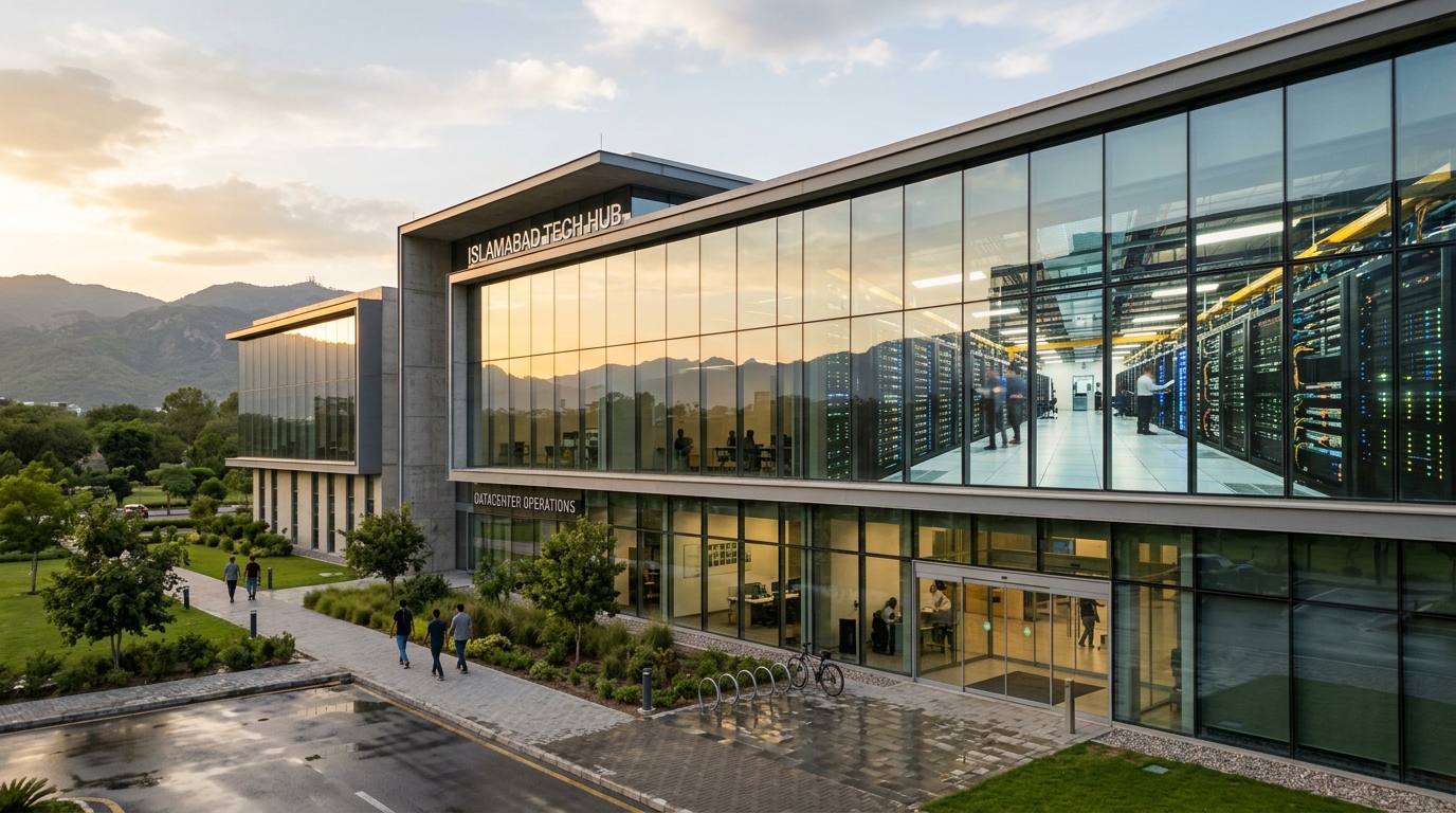
To maintain continuous 99.999% uptime, weather simulation clusters and emergency telemetry backbones mandate domestic hosting on dedicated, unshared hardware. High-performance Dedicated Servers and localized Dedicated Servers in Pakistan housed in redundant Tier-3 and Tier-4 datacenters provide the raw compute throughput, zero virtualization latency, and direct multi-gigabit Pakistan Internet Exchange (PKIX) peering necessary to safeguard national life and infrastructure.
Explore our technical architectural resources:
- Linux eBPF & XDP Line-Rate Packet Filtering Guide
- Enterprise Disaster Recovery & RPO/RTO Optimization Strategies
- High-Performance NVMe Database Architecture for High-Concurrency Applications
Power Your Mission-Critical Workloads with Nextgen
Deploy enterprise-grade bare-metal dedicated servers and high-speed Cloud VPS in Pakistan. Pure Gen4 NVMe storage, unmetered domestic bandwidth, and carrier-neutral Tier-3 datacenter reliability.